Search engine for discovering works of Art, research articles, and books related to Art and Culture


Javascript must be enabled to continue!
Aegyptus Hodierna, Map of Egypt
View through The Met
Etching and engraving hand-colored on laid paper
Rights: Public Domain
Drawings and Prints, Metropolitan Museum of Art New York NY, Gift of Elaine and Lewis Dubroff 2014
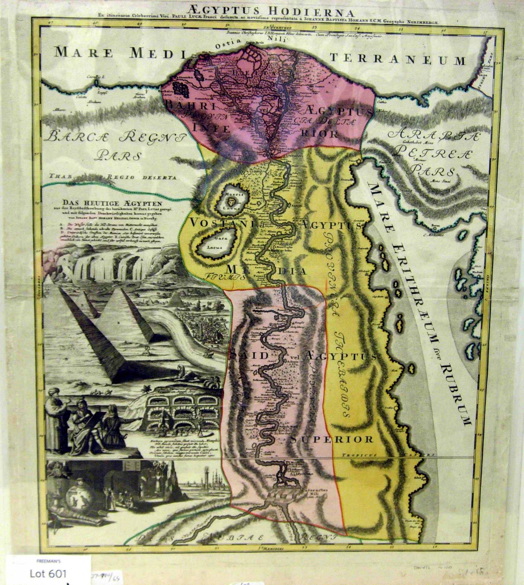
Title: Aegyptus Hodierna, Map of Egypt
Description:
Etching and engraving hand-colored on laid paper.
Related Results
Aegyptus hodierna ex itinerary celeberrimi viri Pauli Lucae Franci desumta ac nuovo repraesentata
Aegyptus hodierna ex itinerary celeberrimi viri Pauli Lucae Franci desumta ac nuovo repraesentata
Calcography, 555x470 mm, date of publication of the printer's years of activity from the year of his appointment as an imperial geographer...
South west coast of England from Exeter to Land's End,
1539-40
South west coast of England from Exeter to Land's End,
1539-40
This is a map of the south-west coast of England,
from Exeter to Land’s End. It dates from 1539-40 and its creation
can be imputed to the threat of invasion which became probable i...
PLAN of the Cities of LONDON and WESTMINSTER the Borough of
SOUTHWARK and PARTS adjoining Shewing every HOUSE. By R.
Horwood.
PLAN of the Cities of LONDON and WESTMINSTER the Borough of
SOUTHWARK and PARTS adjoining Shewing every HOUSE. By R.
Horwood.
This magnificent map covers 32 sheets, each
measuring 21" 5/8 x 19" 3/4. It was published sheet by sheet
between 1792 and99 and was the work of several engravers under the
directio...
Das heutige Europa - Landkarte - Propaganda -Illustrierte Broschüre - [2 Szenarien mit Karten] - Berlin
Das heutige Europa - Landkarte - Propaganda -Illustrierte Broschüre - [2 Szenarien mit Karten] - Berlin
"Opposing the “Europe of the Future” in the Allied Brains. Today’s Europe after the war map, as they designed the allied army of the central powers. Answer and fist pledge against ...
ANGLIAE, SCOTIAE & Hiberniae Nova Descriptio - Plate
4
ANGLIAE, SCOTIAE & Hiberniae Nova Descriptio - Plate
4
This map of the British Isles is by Gerard
Mercator. It dates from 1564 and was produced in Duisburg. It was a
major new depiction of the British Isles at the time. It is a giant
m...
ANGLIAE, SCOTIAE & Hiberniae Nova Descriptio - Plate
5
ANGLIAE, SCOTIAE & Hiberniae Nova Descriptio - Plate
5
This map of the British Isles is by Gerard
Mercator. It dates from 1564 and was produced in Duisburg. It was a
major new depiction of the British Isles at the time. It is a giant
m...
ANGLIAE, SCOTIAE & Hiberniae Nova Descriptio - Plate
6
ANGLIAE, SCOTIAE & Hiberniae Nova Descriptio - Plate
6
This map of the British Isles is by Gerard
Mercator. It dates from 1564 and was produced in Duisburg. It was a
major new depiction of the British Isles at the time. It is a giant
m...
ANGLIAE, SCOTIAE & Hiberniae Nova Descriptio - Plate
7
ANGLIAE, SCOTIAE & Hiberniae Nova Descriptio - Plate
7
This map of the British Isles is by Gerard
Mercator. It dates from 1564 and was produced in Duisburg. It was a
major new depiction of the British Isles at the time. It is a giant
m...